Irrigation Estimating Software for Contractors
Same Day Estimates Improve Flow of Business
Design and win more irrigation jobs with precise system layouts, detailed estimates, and an organized workflow from sketch to signed proposal. Map zones, lateral and main lines, valve groupings, and sensor placements on-site, using topographical drawings to account for grade and water flow, with pipe lengths and sprinkler counts calculated as you draw. Sales teams close with tailored on-site proposals, and crews install from the same detailed drawings and annotated photos, so every job runs off accurate numbers.
Estimate Irrigation Jobs Faster
Trusted by the Pros. Honored for Innovation.





21+ million drawings, takeoffs, and proposals created with ArcSite!


















Key Features to Simplify Irrigation Projects
On-Site Irrigation Software for Plans in Minutes
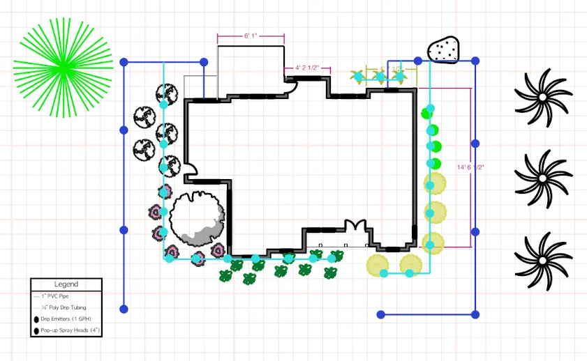
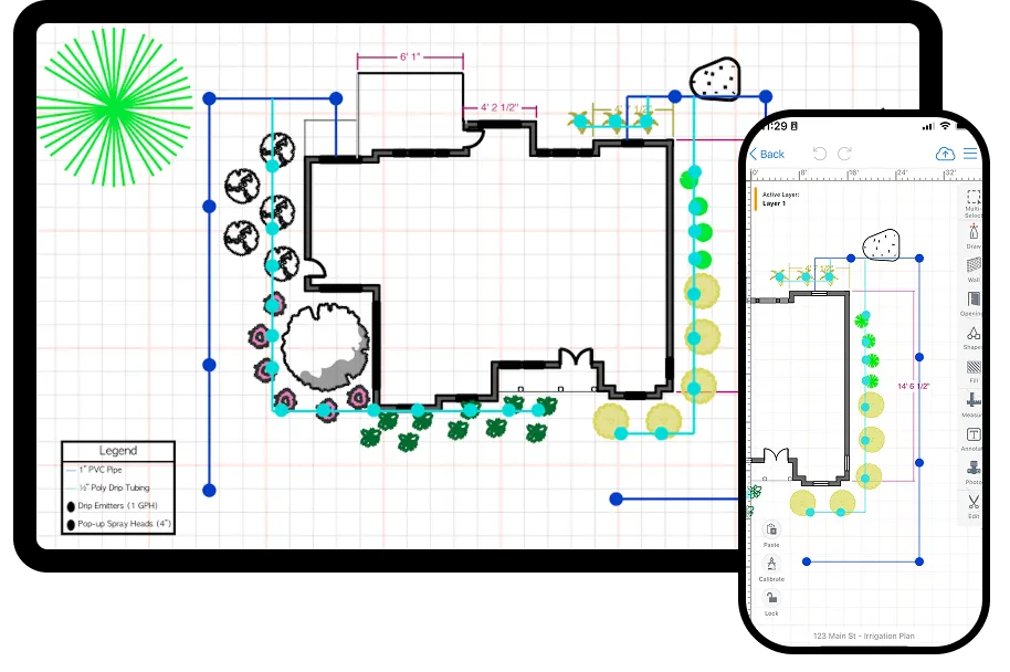
Ditch paper sketches and outdated desktop tools. ArcSite's irrigation software makes it easy to design irrigation systems right on your tablet or phone.
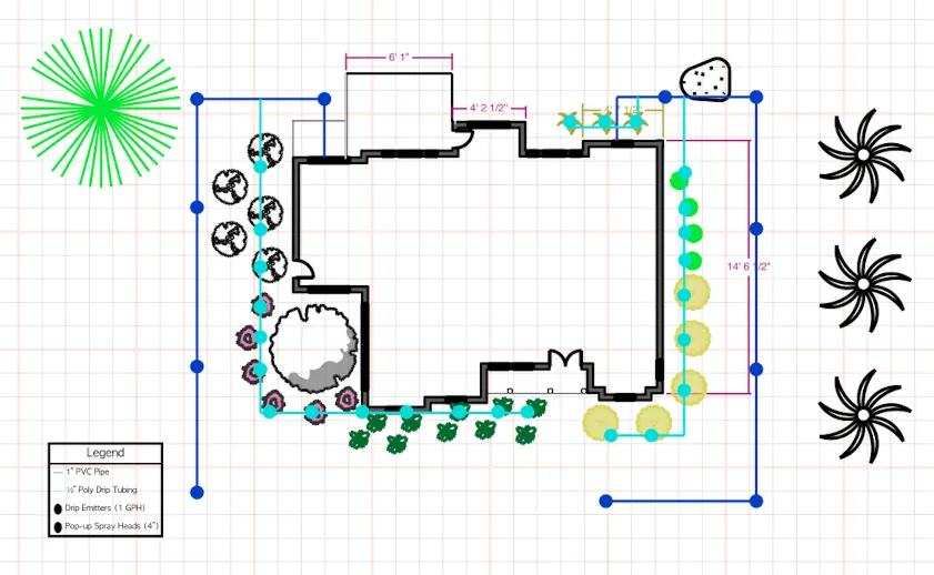
- Create precise irrigation layouts, including zones, valve placement, pipe runs, and controller locations
- Add measurements, notes, and photos for full project context
- Produce clean, professional drawings that clients can understand and approve
Instant Takeoffs and Material Lists
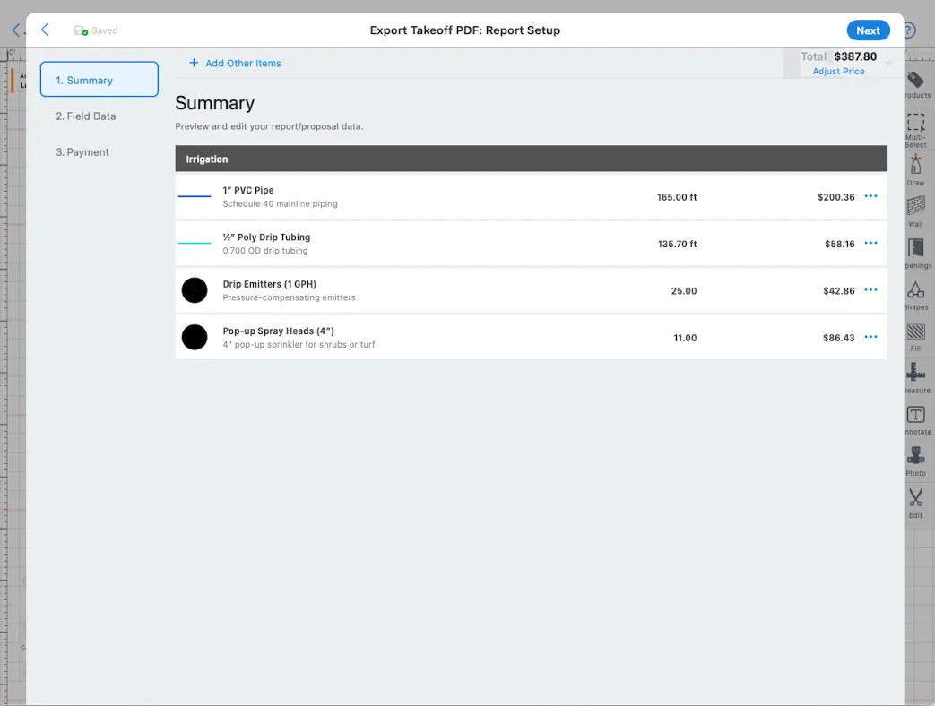
Speed up planning and purchasing with automated calculations based on your actual layout.
- Automatically calculate pipe lengths, emitters, valves, controllers, and fittings
- Customize material libraries with your preferred brands and specs
- Eliminate manual math errors and reduce overordering
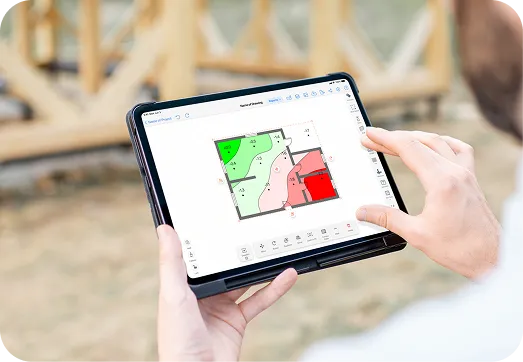
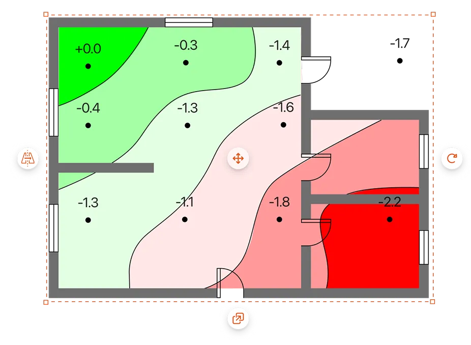
Plan irrigation zones and water flow with precise site grading
Map elevation changes across the property to guide valve placement, pipe runs, and drainage before you finalize the design.
Get the most of out of your landscape irrigation software
Stay on budget with fast, reliable takeoffs.
- Get precise quantities for pipes, heads, valves, timers, and connectors
- Avoid costly overages with layout-based calculations
- Adjust easily for last-minute changes in the field
Design systems to fit any site, from small lawns to large commercial properties.
- Easily draw zones, lateral and main lines, valve groupings, and sensor placements
- Make on-site adjustments with mobile-friendly system design tools
- Keep your workflow clean and professional, even on complex installs
ArcSite travels with you, making fieldwork irrigation inspections or new installations easier than ever.
- Draw, edit, and estimate from your tablet or smartphone
- Sync updates instantly across your team
- Work offline and upload changes when you’re back online
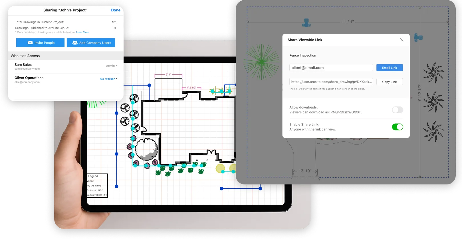
Keep your team aligned throughout the job lifecycle.
- Share drawings, material lists, and pricing instantly
- Ensure installers always have the latest information
- Centralize everything from design to delivery
Capture site elevation and slope data directly in your landscape drawing. Get automatic contour lines and color-graded fills so you and your client have a clear picture of grade, drainage, and layout before the project begins.
Hear It From the Pros Using ArcSite Every Day
Listen to stories from professionals like you who used ArcSite to save them time, reduce costs, and alleviate daily work frustrations.


.webp)
Related posts


Free Tools for Landscape Pros
.webp)
Download free landscaping templates and tools to simplify your workflow, save time on every project, and start designing with confidence using ArcSite
Frequently Asked Questions
Got questions? We're here to help! If you can't find what you're looking for, don't hesitate to reach out.