TOPOGRAPHICAL DRAWING SOFTWARE | SITE ELEVATION MAPPING
Show the elevation. Win the job.
Built for foundation repair, turf, and landscaping pros, ArcSite's topographical drawing tools lets you show customers exactly what's happening on-site with contour lines and color-graded heatmaps, right at the kitchen table.


21+ million drawings, takeoffs, and proposals created with ArcSite!


















Elevation drawings built for the field
Add elevation points directly to your drawing and automatically generate contour lines and color-graded heatmaps. No external tools, no extra steps, no manual sketching.
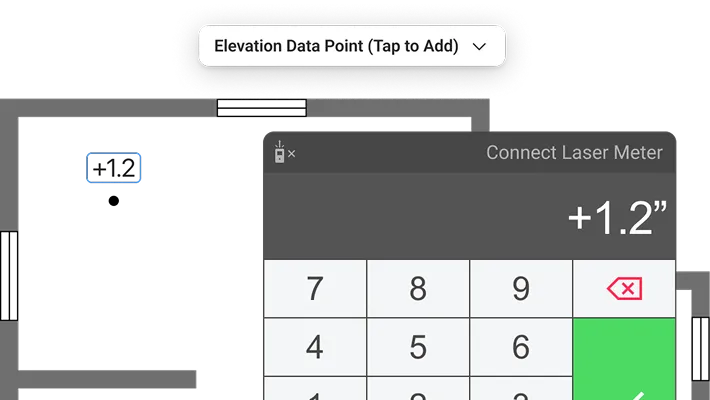
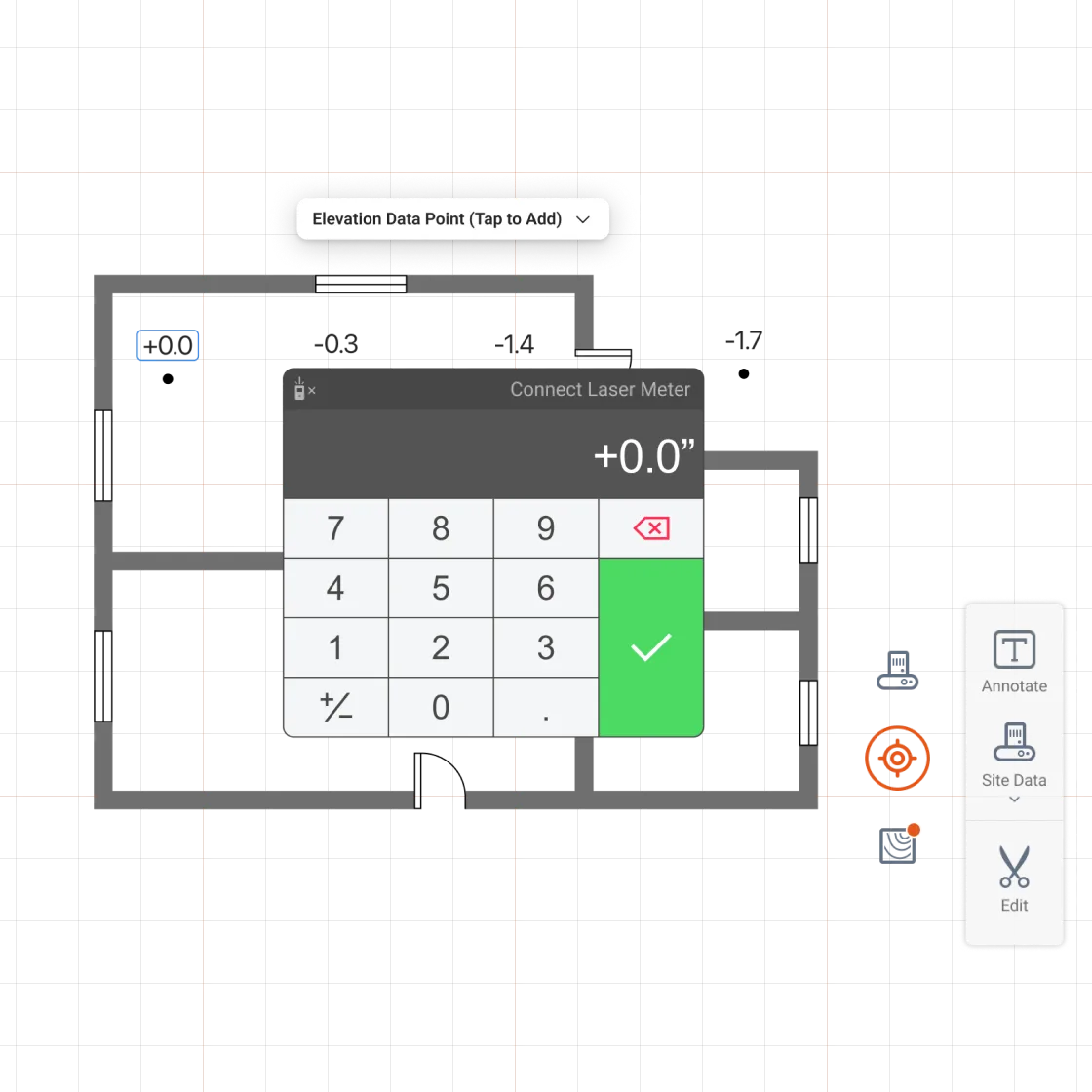
Enter elevation points, right in the drawing
Capture elevation data directly inside your drawing on-site.Our extensive library of pre-made shapes cater to a wide range of spaces, from architecture to engineering.
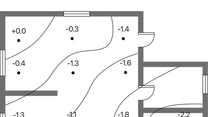
Auto-generated contour lines
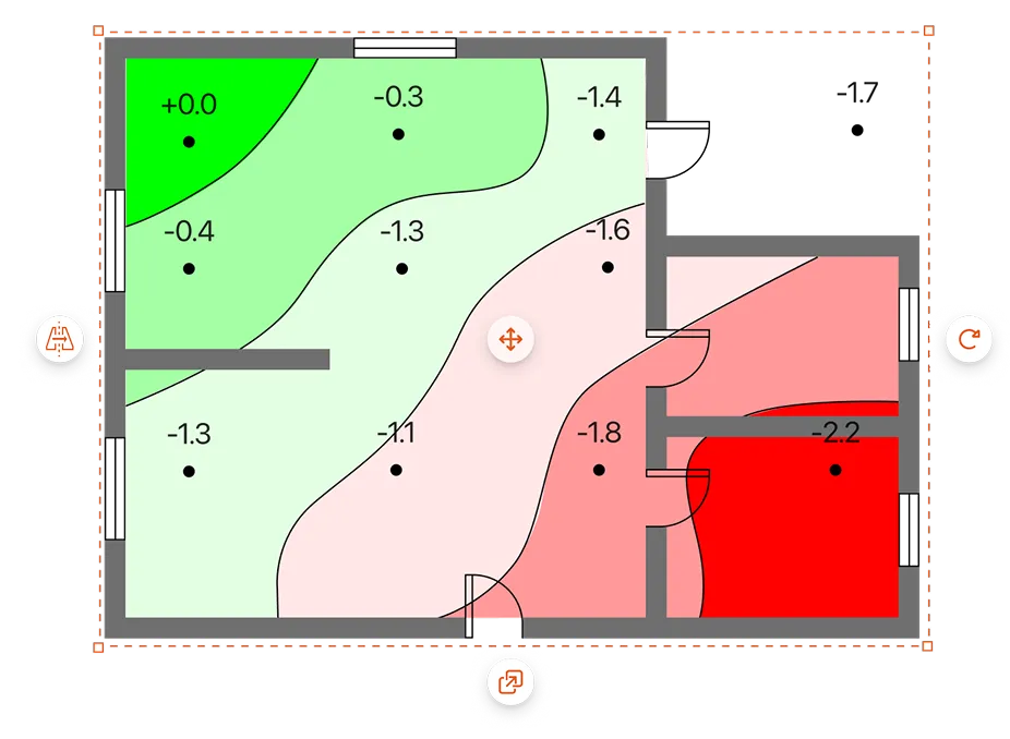
Turn your elevation points into a clean, professional contour line drawing automatically. What used to take 10-15 minutes of manual work happens in seconds.
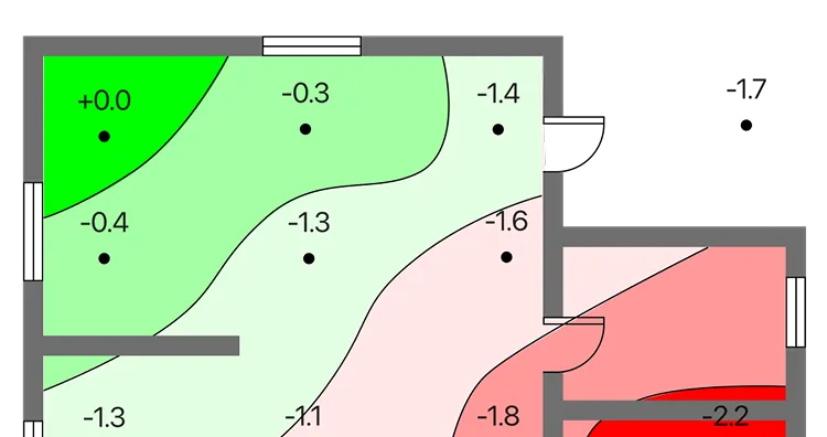
Color-graded heatmaps at a glance
High and low elevation areas show up instantly in easy-to-read color fills. Clients understand what's happening on their property without needing a technical explanation.
Close more high-ticket jobs on-site
When homeowners can see the elevation data laid out in front of them, approval rates on high-value jobs go up. Show the problem, close the deal.

Standardized output across your whole team
Consistent contour lines and color fills, no matter who runs the job. New reps ramp faster and every drawing looks like it came from your best estimator.
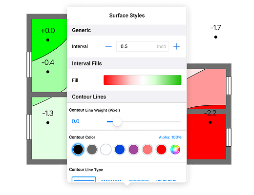
Price for real-world elevation, not just flat distance
Factor in stacked materials, stepped surfaces, and sloped areas when building your estimate. Your quotes match the actual scope of work, so there are no surprises later.


Open your drawing. Add elevation points.
Pull up any drawing on your tablet or phone. Tap to place elevation points directly on the site plan as you walk the property. No switching apps, no separate data capture step.

Generate the contour map automatically.
Once your elevation points are in, it builds the contour lines and color-graded heatmap for you. The visual is ready in seconds, standardized every time, and looks the same whether you or your newest hire ran the job.Once the basic layout is in place, ArcSite’s vast library of pre-made shapes and custom shape creation tools come into play. Select from existing shapes or create new ones to accurately represent specific design elements.

Show the client.
Close the job.
Walk the homeowner through the drawing right there on-site. They can see exactly where the elevation changes are, what the problem looks like, and what needs to be done. When the problem is visible, the decision is easier.
Start Winning More BidsTrusted by the Pros. Honored for Innovation.





Frequently Asked Questions
Got questions? We're here to help! If you can't find what you're looking for, don't hesitate to reach out.