AR Room Scanner for Contractors
Skip the manual measurements
Scan interiors, exteriors, walls, and linear runs with your iPhone or iPad Pro. ArcSite turns the scan into an editable floor plan, bill of materials, and estimate in minutes.


21+ million drawings, takeoffs, and proposals created with ArcSite!


















Scan any job site and get a digital plan in minutes
Scan walls, linear footage, cracks, or fence lines with AR and turn them into precise drawings and project plans. Capture measurements automatically, add job-site photos, and price the project as you scan. No tape measure required.


Measure and price job sites in minutes, not hours
Capture fence lines, foundations, interior walls, and other area or linear measurements with AR to create precise site plans. Place products while you scan and price the job in real time, so the bill of materials is built before you leave the site.
Leverage built-in AR technology
Every scan becomes a layered, editable drawing, so you spend your time designing and building instead of measuring.
Scan to Floor Plan
Use LiDAR to turn a room scan into an editable 2D floor plan. No sketching by hand.
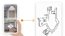
Just Your iPhone or iPad Pro
No extra hardware. Scan with the LiDAR sensor already built into iPhone Pro and iPad Pro models.
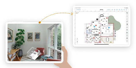
Walls, Doors, and Openings Detected Automatically
Scanning picks up walls, doors, and room openings on its own. Take photos and place products as you go, and the drawing builds in real time.
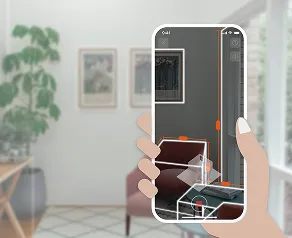
Price and Place Products as You Scan
Pull products from your library onto the scan, and ArcSite builds the bill of materials and proposal for you, in about half the time.

Measure and Plan Interior & Exterior Jobs
Scan rooms, basements, foundations, and fence lines in seconds. For big yards and grade work, pair ArcSite with Moasure or Smart Level and map elevation with topographical drawing. Prefer a laser measure? Bosch and Leica connect over Bluetooth.


Scan, Capture, and Create in Seconds
Skip the tape measure. Just scan your space, and watch as a 2D floor plan is auto-generated. No manual measurements, no complicated setup. Just point, scan, and start designing.
Auto-Detect and Place Fixtures
Once your scan is complete, add details in seconds using ArcSite’s intuitive shape library or by customizing elements to match your design. Whether it’s fixtures, furniture, or materials, you can refine your plan with just a few taps.
Price and Quote while you scan
Apply products from your library directly to the scan to build an accurate bill of materials and proposal, without pulling out a tape measure or re-entering anything back at the office.
Discover the full potential of ArcSite
The AR scanner is the fastest way into an ArcSite drawing. Explore everything that happens after the scan.
Frequently Asked Questions
Got questions? We're here to help! If you can't find what you're looking for, don't hesitate to reach out.