Field Inspection Software
Streamline Inspections to Improve Accuracy and Save Time
ArcSite’s Field Inspection Software helps inspection teams collect data, generate reports, and ensure compliance—all from a mobile device. Whether you’re handling safety checks, quality inspections, or compliance audits, ArcSite gives you the tools to complete the job faster and with fewer errors.


Get STarted With a demo
Trusted by the Pros. Honored for Innovation.


Field Inspection Software
Streamline Inspections to Improve Accuracy and Save Time
ArcSite’s Field Inspection Software helps inspection teams collect data, generate reports, and ensure compliance—all from a mobile device. Whether you’re handling safety checks, quality inspections, or compliance audits, ArcSite gives you the tools to complete the job faster and with fewer errors.
11+ million drawings, takeoffs, and proposals created with ArcSite!


Key Features for Inspection Professionals
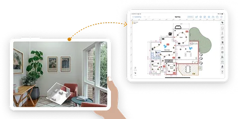
Streamline Inspections with Powerful Drawing Tools
ArcSite’s Field Inspection Software combines drawing and data collection tools to help teams document sites, capture issues, and generate reports—all from a mobile device. Whether you’re handling safety checks, quality inspections, or compliance audits, ArcSite gives you the power to visualize and report with accuracy.
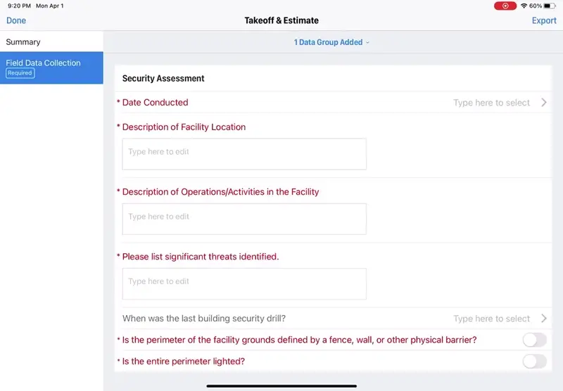
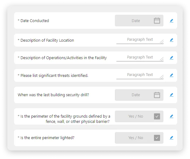
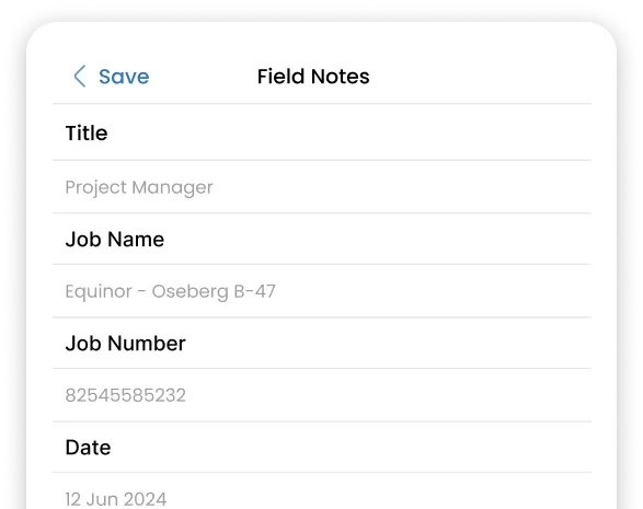
Data Collection & Customized Templates
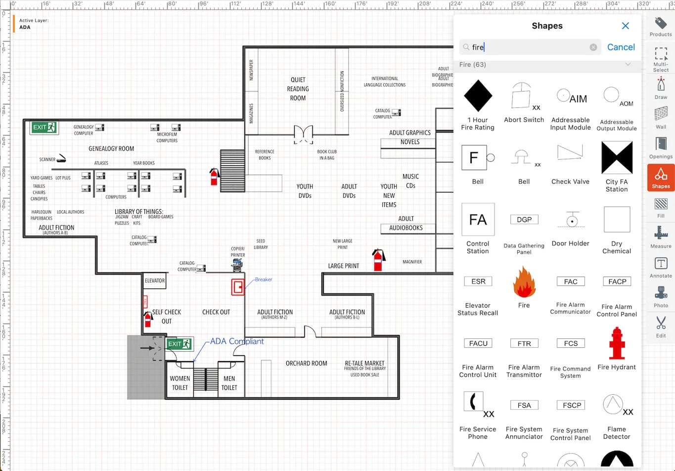
ArcSite isn’t just about drawings—it’s also a powerful data collection tool. Capture inspection details through customized form templates designed for mobile device in field application. Build checklists with required fields, photo capture, and signature boxes, ensuring that every inspection follows a consistent process. By linking these templates directly to site drawings, you gain a complete record that combines visual accuracy with structured data, making reporting and compliance easier than ever.
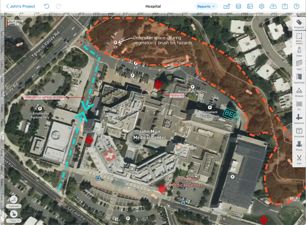
Satellite Maps for Smarter Inspections
With ArcSite, you can overlay your drawings and inspection notes directly onto satellite maps. This feature allows inspectors to orient themselves quickly on-site, visualize property boundaries, and mark exact problem areas with GPS accuracy. Satellite maps also make reports more professional and easier to interpret, giving clients a clear picture of where each issue is located.
Built for Field Inspection Teams
Field Inspectors
Inspection Managers
Business Owners

Get the most of out of your field inspection software
Capture conditions visually with scaled drawings, markups, and photos, eliminating guesswork. Whether you're inspecting a construction site or utility lines, key data can be captured through clear documentation.
Standardize inspections with tailored forms that link directly to site plans. Allow safety inspection teams to perform routine checks with predefined requirements that all feed into the project.
Keep inspectors, managers, and clients aligned with shared drawings and real-time updates. Site survey jobs can be collaborative with office and field teams using cloud connectivity.

Work anywhere—even in remote areas—with automatic syncing once online. The ArcSite inspection management system offers robust features to keep you focused in the field.
Create floor plans in seconds using a iPhone LiDAR technology to easily capture spaces needed for building inspections.
Our users rave about the benefits they experience with ArcSite.
Listen to stories from professionals like you who used ArcSite to save them time, reduce costs, and alleviate daily work frustrations.


Frequently Asked Questions
Got questions? We're here to help! If you can't find what you're looking for, don't hesitate to reach out.