ArcSite Launches Topographic Drawings, Turning Elevation Problems Into Something Customers Can See
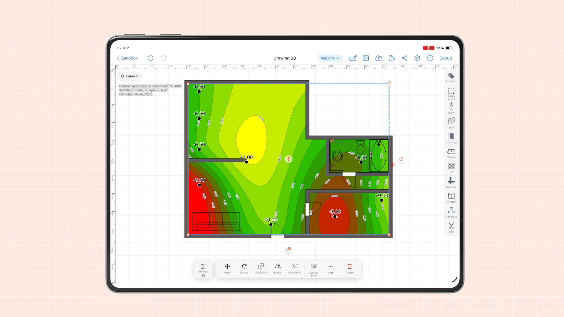

Grand Rapids, MI – August 03, 2026 – ArcSite, the field software that keeps the job going with drawings, material takeoffs, proposals, and payments, today announced the launch of Topographic Drawings, a new innovation that lets contractors capture elevation data on-site and instantly generate contour line drawings and color-graded heatmaps, directly inside ArcSite.
Creating Visualizations in the Field
Explaining an elevation problem has always been the hard part. A verbal description falls short. A hand sketch takes time, and it looks different depending on who's holding the pencil. Sending it out to a separate visualization tool means extra steps, extra software, and output that varies from job to job.
Whatever you call it settling, drainage, grading, or slope the challenge is the same: turning a number into something the customer can actually see.
ArcSite’s Topographic Drawings eliminate that gap. Field reps can now place elevation data points directly on their drawing, set a reference point, and generate a professional contour map automatically, without leaving the app or switching tools. The result is a visual customers can immediately understand, right at the kitchen table, when it matters.
"Topographic Drawings came directly from what our customers were telling us," said Scott Weigel, ArcSite’s COO. "Reps were spending a lot of time verbally explaining the issues with the homeowner's property because they didn't have a way for them to visualize the actual problem. When someone can see exactly what's happening on their property, like the elevation changes and the scope, they can say yes quicker. Topographic Drawings close the gap between what the rep knows and what the customer understands, and that's what wins jobs."
Built for the Field & Designed to Grow your Business
Topographic Drawings create efficiencies for contractors during the field visit because of the clear visualization. Because elevation is built into the drawing and not approximated after the fact, estimates also better reflect the real scope of work. The feature is fully standardized across teams, meaning a rep in their first week produces the same professional output as one with five years on the job.
To learn more, visit: https://www.arcsite.com/features/topographical-drawing-software
About ArcSite
Founded in 2014, ArcSite is field software that keeps the job going: drawings, material takeoffs, proposals, and payments. From the first line to the last dollar, we put time back in your day.
Categories
INDUSTRY


FAQs
Related posts