Lawn Irrigation Design Tool
Plan Lawn Irrigation with Accuracy and Speed
ArcSite’s lawn irrigation design tool revolutionizes planning and installation by turning site measurements into precise blueprints and cost estimates. Simplify your workflow and impress clients with stunning accuracy—ditch the guesswork and inefficiencies for good.

Lawn Irrigation Design Tool
With the Lawn Irrigation Design Tool, creating your perfect landscape system is effortless. Design customized irrigation layouts, optimize water distribution, and ensure uniform coverage for your lawn—all without the complexity of traditional methods.
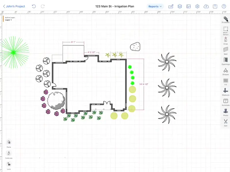
Customizable Components for Lawn Irrigation Design
Leverage ArcSite’s library of reusable shapes tailored for lawn irrigation design. Drop in components, create branded shapes, or reuse templates to streamline layouts effortlessly.

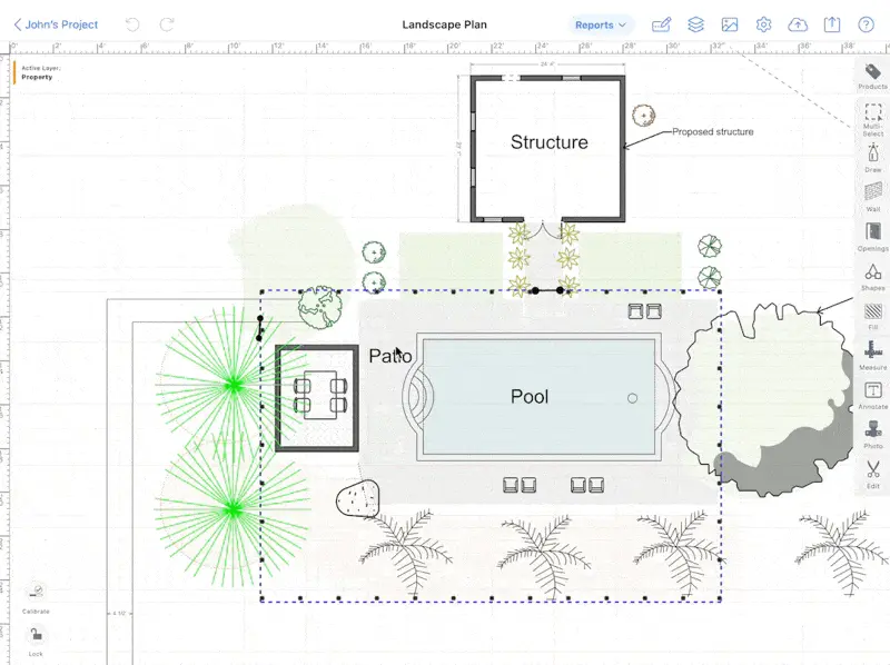
Visual scope management for lawn irrigation projects
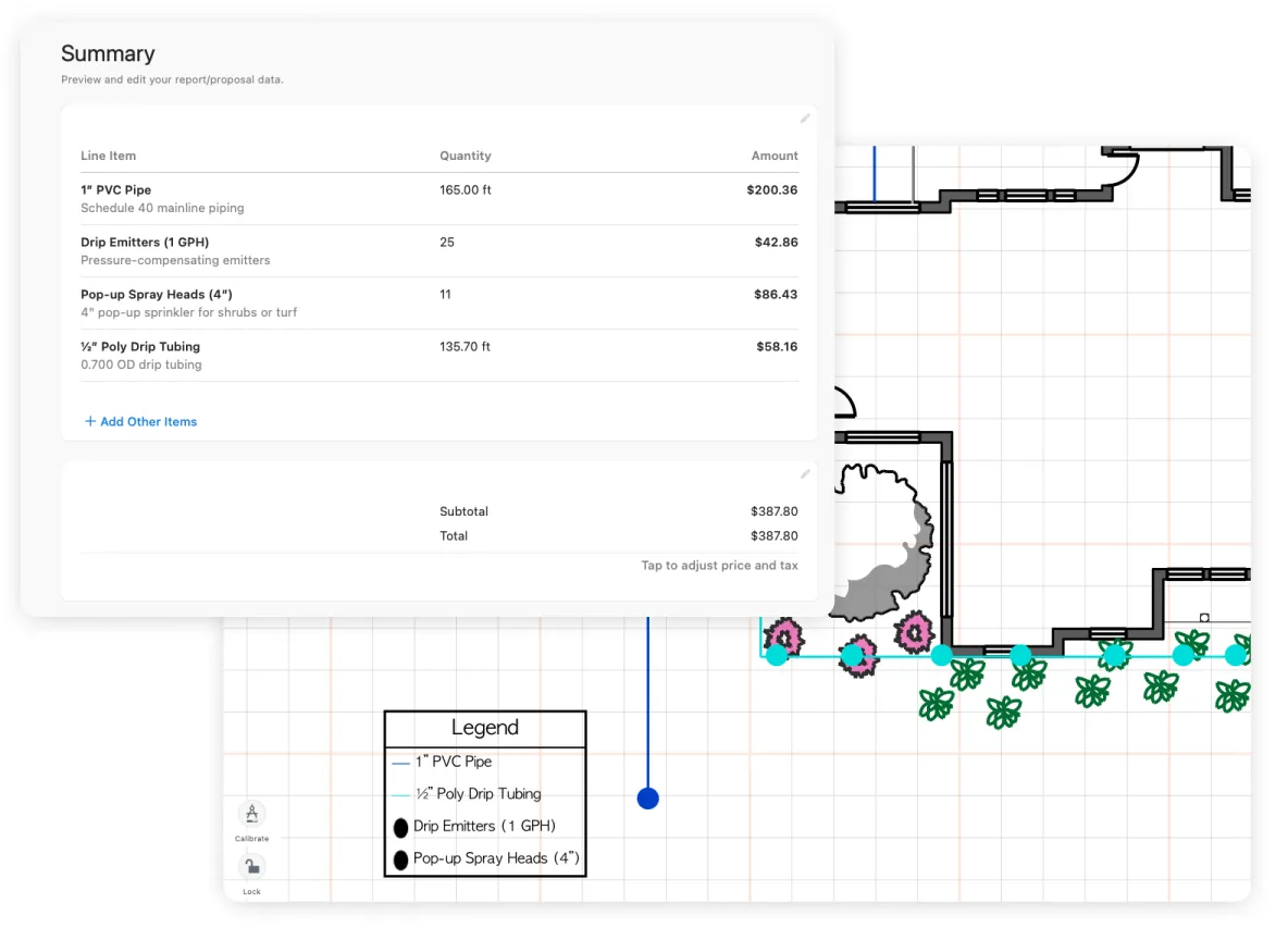
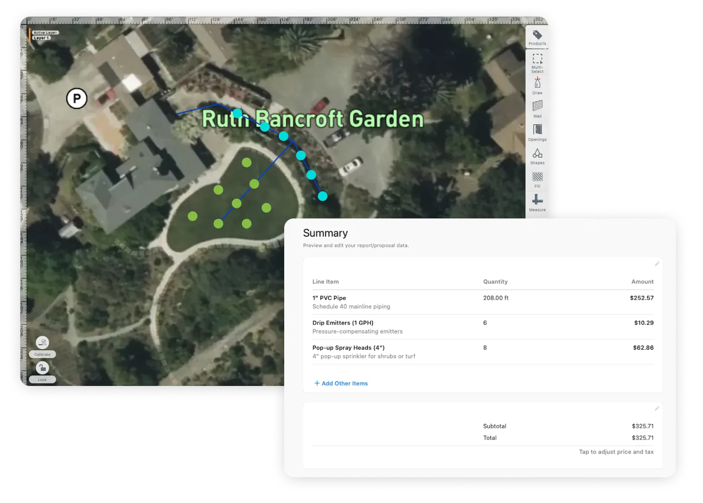
ArcSite automatically calculates pipe lengths, sprinkler counts, and zone layouts as you design, keeping your irrigation plans organized, accurate, and easy to share.
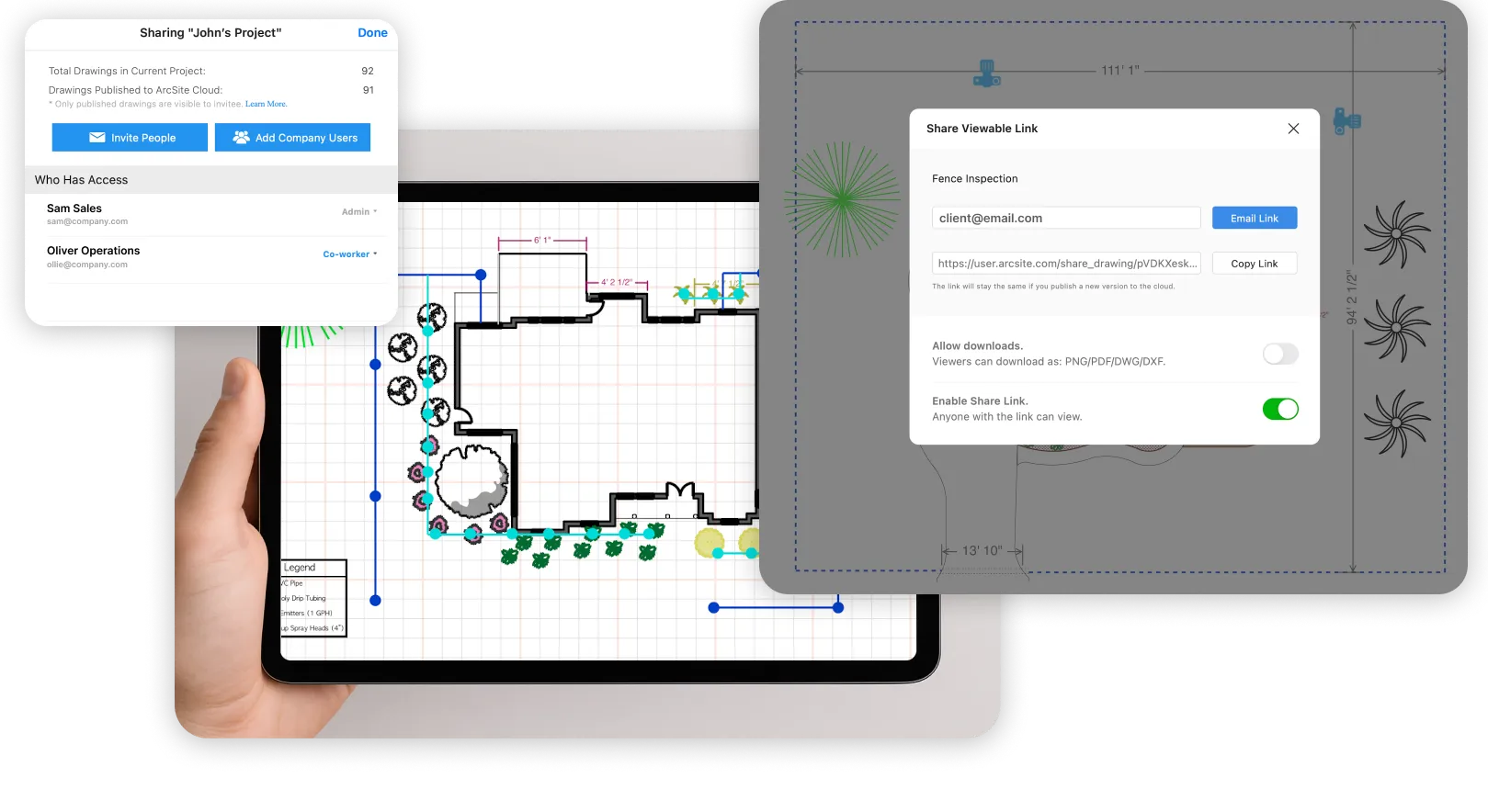
Streamlined Lawn Irrigation Collaboration
ArcSite enables real-time feedback on irrigation layouts. Share, get manager approvals, or customer input instantly, ensuring designs are accurate, efficient, and tailored to every lawn's needs.
Design lawn irrigation systems with satellite precision
Streamline your irrigation designs by importing satellite imagery of your landscape. ArcSite auto-calibrates for scale, ensuring accurate layouts and efficient water coverage, reducing errors and saving time.
Unbounded canvas for complete irrigation system layouts
Map residential yards or extensive golf courses—without limitations. ArcSite’s infinite canvas evolves with your irrigation designs, delivering accuracy and adaptability through every project phase.
Get an industry-focused demo of ArcSite to see all the benefits your team can use to work more efficiently.
Get a DemoOur users rave about the benefits they experience with ArcSite.
Listen to stories from professionals like you who used ArcSite to save them time, reduce costs, and alleviate daily work frustrations.

“The very first day that I was using ArcSite in the field, I was able to close a $42,000 job in about 45 minutes. That process before would take anywhere from two to three hours minimum.”
Nick Birchoff
Lead Estimator - Nevada Fence

45-Minute $42,000 Deal Closure with Efficient ArcSite Sketching
Estimation Time Reduced from Hours to Minutes, Enhancing Productivity
On-Site Estimates with ArcSite Increased Close Rates by Over 70%
Unique Competitive Edge in Market Due to ArcSite's Powerful Features

“I am so accurate with all my drawings and measurements. Now, our engineers have all the information they need and can answer questions on the spot.”
Collin Dozier
Field Inspector - JES Foundation Repair

Over $2 Million in Sales with ArcSite's Precision Drawing Tools
Streamlined Site Visits: Digital Plans on First Visit, Eliminating Redraws
Enhanced Field Accuracy: Real-Time Photo Sharing and Crawlspace Navigation with ArcSite
Increased Customer Engagement: Detailed, Professional Presentations Using ArcSite

“I can confidently say that ArcSite has revolutionized our workflow. The clarity and precision it brings to project planning and execution are unparalleled; it directly contributes to our clients' satisfaction and our business success.”
Rick Randall
Owner - Pinehurst Turf Pros

Revolutionized Project Approach: Time-Saving Precision with ArcSite and Moasure
Error-Free Measurements: Elevated Field Accuracy Boosts Service Excellence
Streamlined Administration: Single, Digitally Signable Contract PDFs Enhance Client Experience
Client Engagement and Satisfaction Soared: Clear, Comprehensive Project Illustrations with ArcSite
“I went to the site Monday without ArcSite, spent all afternoon printing then marking up on A4 paper. Once I returned, I had to then scan it, convert it to PDF, upload it to Autodesk Design Review, then mark up all the circuits using the correct symbols onto the system. All this could have been done at the source [using ArcSite]. Instead, it was done at the office, wasting many hours of time.”
Paul Gibson
Surveyor - Johnson Controls

Halved Field Time: ArcSite's Efficient Drawing and Data Collection
Accurate Data in Single Visits: Eliminated Rework with ArcSite’s Digital Tools
Enhanced Team Collaboration: Instant Data and Photo Sharing with ArcSite
Custom Solutions for Complex Systems: ArcSite’s Custom Shapes and Photo Integration

Trusted by the Pros. Honored for Innovation.